Daxdi now accepts payments with Bitcoin

Auction: Software DJI Terra Insignia

Remaining time

--:--:--

Current price

$39.00 $40.00

$39.99

The user jovakaricmilun is winning the auction.
Latest bids
jovakaricmilun
$39.99
Karolinanov
$0.00
Krarupwerner
$0.00
Auction info

Product value

Savings

Daxdi coins value

$16,588.00

$16,548.01

4

The user jovakaricmilun is winning the auction.
Participants with a seat in this auction
1. Hamillmerlin
2. kennethsommer
3. jovakaricmilun
4. Westzackery
5. Thorolfslil
6. Benedikta22
7. erna95
8. Krarupwerner
9. Karolinanov

Auction information

  • Current price

    $39.99

  • Product value

    $16,588.00

  • Auction ID

    202927

  • Auction type

    Private auction

  • Bid value

    4 Daxdi coins

  • Initial price

    $40.00

Statistics of the last 15 days

  • Average number of participants

    1 users

  • Average amount of bids done by the winners

    0 Daxdi coins

  • Average published times in a week

    0.07 times

  • Average final price

    $12.38

  • Average savings of the winners

    $16,587.93

  • Average spending by winners

    $0.00

Latest winners

  • 12.38€

    2026-02-26 08:45:16

  • 4.76€

    2026-01-07 07:32:13

There are not more finished auctions of this product on last 30 days

Shipping

The product will be shipped within a maximum of 24 hours once you have won and paid for the auction.

The auctioned product is available to be exchanged for its cash value

For more information about the products' delivery or exchange for their cash value, you can consult the FAQs or open a support ticket

Buy product

You can buy this product in any moment, if you have placed bids in this auction the bids value will be deducted from the product final price.

Software DJI Terra Insignia

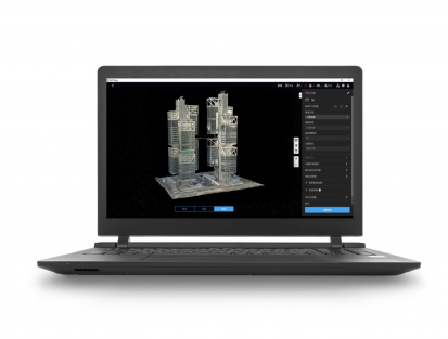
DJI Terra is a 3D modeling software equipped with advanced reconstruction technologies [1], including 3D Gaussian dispersion.

It enables accurate and efficient 2D and 3D visible-light reconstructions, and data processing through DJI LiDAR.

When integrated with DJI drones and DJI Modify [2], Terra offers a unified hardware-and-software solution that spans from data collection to processing and application, making aerial surveying work easier, more efficient, and accurate.

Gaussian Dispersion: Terra introduces Gaussian dispersion, which rapidly generates detailed and realistic 3D models from photos, accurately restoring diverse scenes such as cultural relics, architectural projects, urban blocks, and landscaped gardens.

Photogrammetry: Terra quickly generates high-precision 3D models, point clouds, true digital orthophoto maps (TDOM) and digital surface models (DSM) from photographs.

LiDAR Reconstruction: Terra enables deep integration of LiDAR data and visible light.

With a single Zenmuse LiDAR acquisition, users can simultaneously generate high-precision point clouds, 2D maps, and 3D mesh models.

Multispectral Reconstruction [3]: Takes advantage of multispectral data from the DJI Mavic 3 Multispectral and Phantom 4 Multispectral to generate vegetation index maps, including NDVI and NDRE, to obtain practical information about plant growth and health.

Terra also supports radiometric correction and the creation of reflectance maps for remote sensing research.

Hardware Synergy for Aerial Recognition Across Multiple Scenes: When used with Matrice 4E, Matrice 400, Zenmuse P1, Zenmuse L2 and D-RTK 3, Terra offers cost-effective professional-quality LiDAR and visible-light mapping solutions.

Authorization Modes [4]: Online authorization and offline authorization are supported.

Daxdi

Daxdi.com Cookies

At Daxdi.com we use cookies (technical and profile cookies, both our own and third-party) to provide you with a better online experience and to send you personalized online commercial messages according to your preferences. If you select continue or access any content on our website without customizing your choices, you agree to the use of cookies.

For more information about our cookie policy and how to reject cookies

access here.

Preferences

Continue