
Select your continent to display the countrys and languages.


Your registered currency is eur all transactions in Daxdi will be carried out in this currency.


Current Daxdi servers time 04-07-2026 05:58:38 (CEST)
You currently have lottery credits in your account
You have 0 Daxdi coins in your account.
Please select your continent in order to change your country and language.
Daxdi now accepts payments with Bitcoin
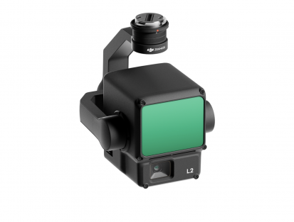
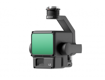
Price: 169,862.00kr
 Price for Daxdi Club members: 118,903.40kr
Stock: Yes (4 units)
 Bitcoin: 0.24576280 BTC
 Ethereum: 8.78404 ETH
 Litecoin: 74134.281 LTC
*Special price available for Daxdi club members, if you are not yet part of the club you can join here
 Log in to your Daxdi account to view your purchase options.
 Free delivery, return and replacement on all orders.
 All purchases include product documentation (if applicable) and 2-year manufacturer's warranty.
 All shipments of products with a value of more than 999€ are covered by a transport damage insurance.
If you purchase the product before 18:00 hours, the product will be shipped in the same day. (Sundays not included).
The products are sent by urgent international shipment carriers, in a maximum of 72 hours your product will arrive at your house.
The virtual products are sent instantly to your registered email address.
![]()
Daxdi a new online auctions world, the biggest auctions house on the world, many different types of auctions, new auctions each 5 minutes, and more than 3 million users registered until 2026
¿Are you not a Daxdi member yet?
![]()
Daxdi a new online auctions world, the biggest auctions house on the world, many different types of auctions, new auctions each 5 minutes, and more than 3 million users registered until 2026
¿Are you not a Daxdi member yet?

At Daxdi.com we use cookies (technical and profile cookies, both our own and third-party) to provide you with a better online experience and to send you personalized online commercial messages according to your preferences. If you select continue or access any content on our website without customizing your choices, you agree to the use of cookies.
For more information about our cookie policy and how to reject cookies
ContinueWe respect your privacy rights, you can choose to disallow the data collection for certain services. However, not allowing these services may affect your experience.
Daxdi.© 2026 All Rights Reserved.